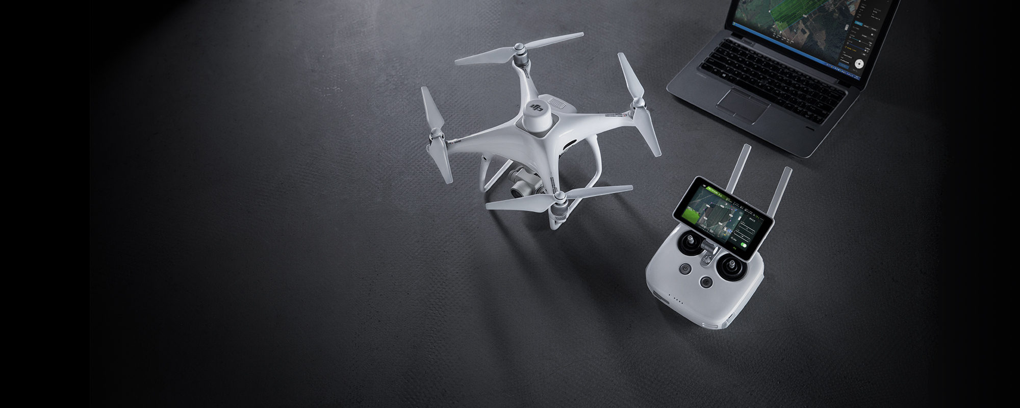
DJI Phantom 4 RTK
The most compact and high-performance DJI solution
for mapping and photogrammetry missions.
Phantom 4 RTK is an intelligent mapping and imaging platform with advanced high-precision mapping features.
The drone is equipped with a proprietary DJI D-RTK system, which offers positioning with centimetre level precision.
Flight safety is ensured by the obstacle avoidance sensors installed in the front, back, sides and on the lower part of the aircraft
The drone’s camera is equipped with a 20-megapixel CMOS sensor, located in a 3-axis stabilization mount.
The camera’s high-performance mechanical shutter eliminates distortion and allows high-speed in-flight image capture.
The images taken by the drone can be processed in DJI Terra or in other mapping software for generating high precission maps for different applications.
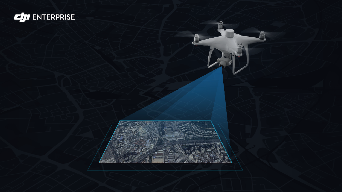
Revolutionise the Photogrametry Industry
Phantom 4 RTK is the result of designing from scratch a system that allows high-precision mapping with a small number of ground control points.
Phantom 4 RTK redefines precision standards in aerial mapping:
- 1cm + 1ppm horizontal RTK positioning precision
- 1.5cm + 1ppm vertical RTK positioning precision
- 5cm absolute precision for the ortophoto models (flight conditions 100m altitude, 2.7cm GSD, sunny weather)
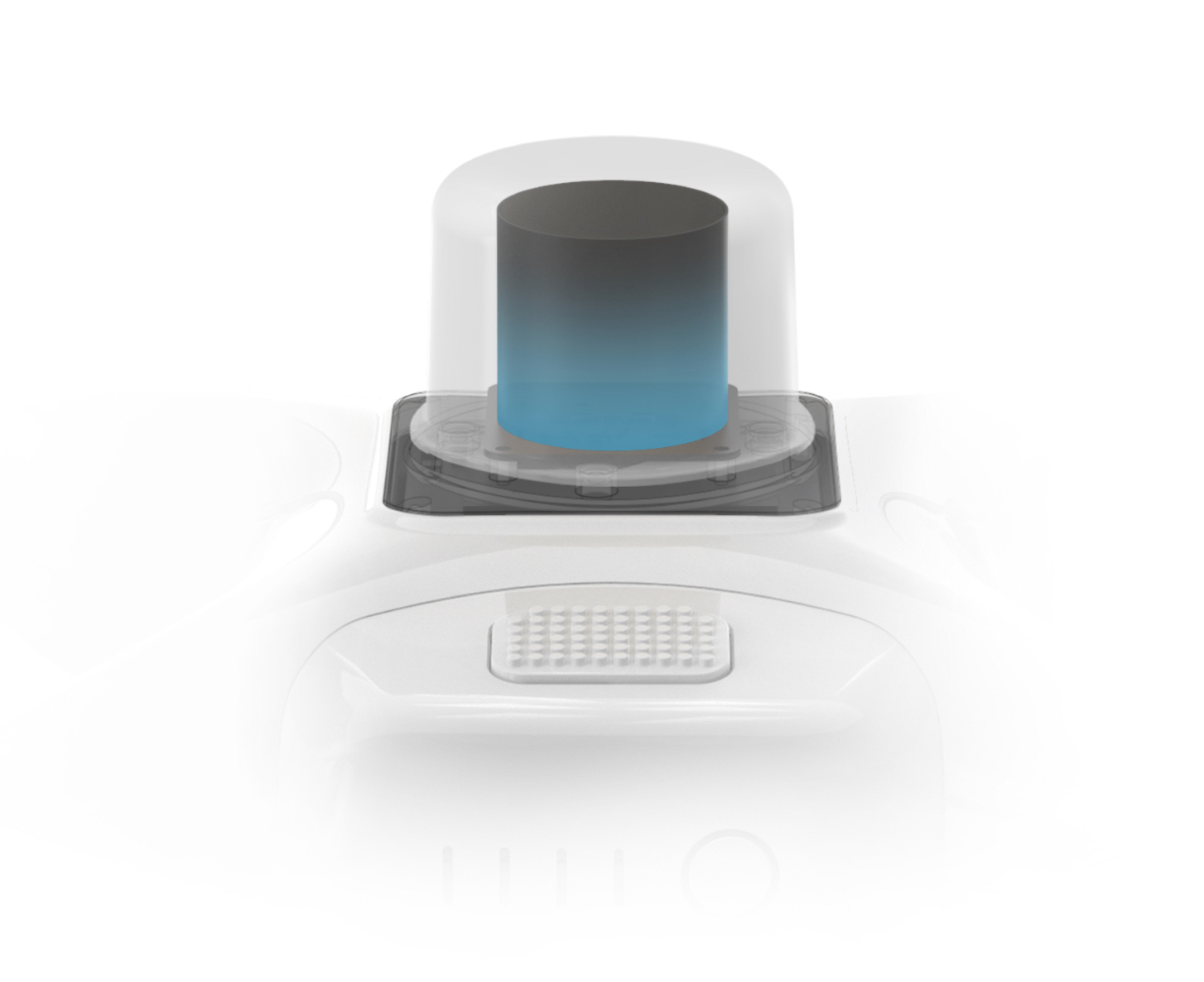
Centimeter level positioning system
A new RTK module is integrated directly into the Phantom 4 RTK, providing real-time, centimeter-level positioning data for improved absolute accuracy on image metadata. In addition to optimized flight safety and precise data collection, the Phantom 4 RTK stores satellite observation data to be used for Post Processed Kinematics (PPK), which can be conducted using DJI Cloud PPK Service*. Fit the Phantom 4 RTK to any workflow, with the ability to connect this positioning system to the D-RTK 2 High Precision GNSS Mobile Station, or NTRIP (Network Transport of RTCM via Internet Protocol) using a 4G dongle or WiFi hotspot.
High precision camera system
The Phantom 4 RTK is equipped with a 20 megapixel, 1″ CMOS sensor. The rolling shutter allows the sensor to capture images even in motion without the risk of image alteration. Thanks to the high resolution camera, the images from the Phantom 4 RTK can produce ortophoto plans of 2.75cm/px at an altitude of 100 meters above the ground level.
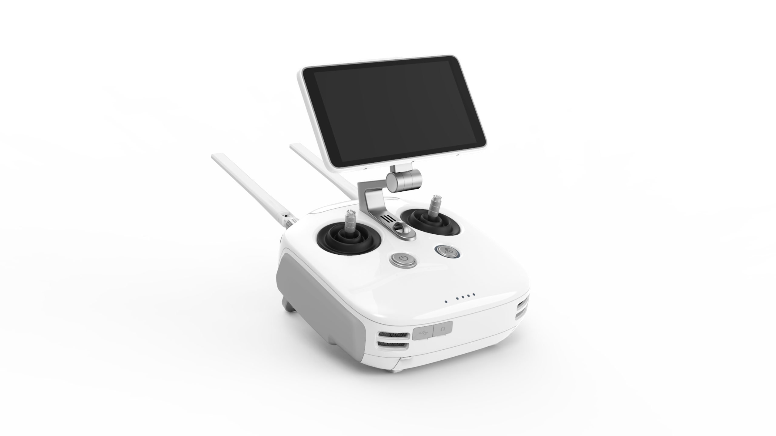
Dedicated solution for flight planning
The new GS RTK application allows intelligent control of Phantom 4 RTK drones by using one of two flight planning modes: Photogrammetry and Waypoints Flight. The flight modes allow the modification of all parameters, offering the possibility to automate the inspection and mapping process. The application allows the loading of KML files for mission planning, the constant preservation of the exposure throughout the flight as well as an alarm system in case the flight conditions become unfavorable.
Start Mapping Today
With a pre-installed flight planning application (GS RTK) and an easy method of collecting RTK data (RTK Network or D-RTK 2 Mobile Station), pilots have a complete, turnkey solution for any type of mission, mapping or inspection.
Full compatibility with D-RTK 2 GNSS
The D-RTK 2 GNSS station integrates seamlessly with the Phantom 4 RTK, providing differential real-time correction data to the drone, thus offering a precise measurement solution. The robust design of the mobile station and the OcuSync 2.0 transmission system allow obtaining accurate data with centimeter level precission with Phantom 4 RTK in any conditions.
DJI Mobile SDK COmpatibility
Phantom 4 RTK is compatible with DJI Mobile SDK, allowing process automation and customization of mobile applications.
OcuSync 2.0 Radio Link
Stable HD video transmission at a distance of up to 7km that allows mapping of large areas.
DJI Phantom 4 RTK
Drone technology has helped the construction industry boost productivity and digitize workflows. The all-new DJI Phantom 4 RTK is the tool that takes construction mapping to a new level. Exceptional surveying deliverables can be achieved thanks to its built-in centimeter-level navigation and positioning system, as well as the high-performance imaging system that supports both RTK and PPK